Overview
HiPER LOOK is a cutting-edge, enterprise-level geospatial data server designed to catalog, organize, and distribute massive volumes of map, imagery, and terrain data at unprecedented speed and scale. Built for both connected and disconnected environments, HiPER LOOK ensures seamless real-time geospatial intelligence access, empowering defense, intelligence, and tactical teams with mission-critical data when and where they need it most.
Whether deployed in secure cloud environments, on-premises data centers, or at the tactical edge, HiPER LOOK delivers high-performance geospatial data streaming and analytics, supporting global ISR operations, mission planning, and rapid intelligence exploitation.
Real-World Use Case
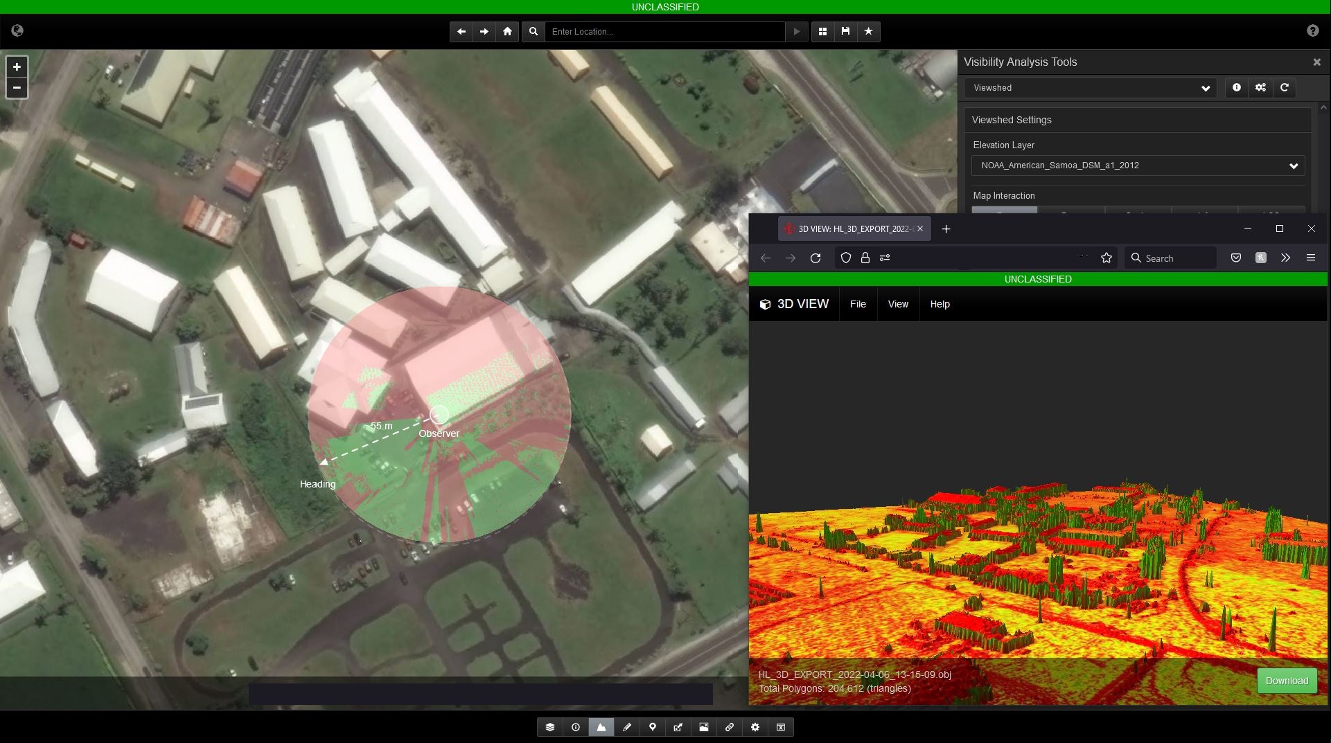
Mission planners, analysts, and operators require a powerful solution for geospatial data visualization and analysis. HiPER LOOK provides real-time terrain analysis, geospatial cataloging, and multi-format data export, allowing users to gain actionable insights and streamline mission workflows. With the ability to scale to massive datasets, HiPER LOOK ensures teams can quickly find, interpret, and utilize geospatial intelligence - whether in connected or disconnected environments.
Key Features & Benefits
- Catalogs and organizes petabytes of geospatial data, including maps, satellite imagery, terrain models, and vector layers.
- Supports real-time data ingestion, processing, and dissemination for immediate intelligence access.
- Optimized for high- and low-bandwidth environments, ensuring data reaches users without delays.
- Eliminate data silos, ensuring a single source of truth for global GEOINT operations.
- OGC-compliant streaming & services
- Powerful web-based viewer
- Delivers real-time, enterprise-wide geospatial intelligence without infrastructure limitations.